So this is probably the single nerdiest thing I've ever done.
The setting for The Saga of the Ortegids, extrapolating from the worldbuilding details we get in the first three Dragon Quest games, is a hollow planet, with Erdland (the world map of Dragon Quest III) on the outside, and Torland (that of Dragon Quest II, which includes that of I) on the inside. Thinking about how both 3 and 2 feature an area where you can obtain a leaf of the Worldtree, I began to ponder how exactly the maps would line up if modeled on a three-dimensional sphere.
So I got a free trial of SketchUp and did exactly that. Look under the cut for more.
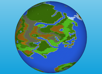
Erdland is a fairly straightforward globe. Here we're centered on Isis. Portoga and Romaly can be seen to the north, with the Southlands below.
Here we can see the Kingdom of Dragons, the Worldforest, and the Inland Sea. You can get a good sense of the Sea's size this way.
Dharma Abbey is roughly in the center of this image, with the area I've designated as Hanguo and Zipangu to the east.
The Eastern Continent, like its real-world doppelganger, takes up much of its hemisphere, spanning polar region to polar region.
Speaking of polar regions, here's a shot centered on Grimland. Note that you can make out the Edinan islands at the top.
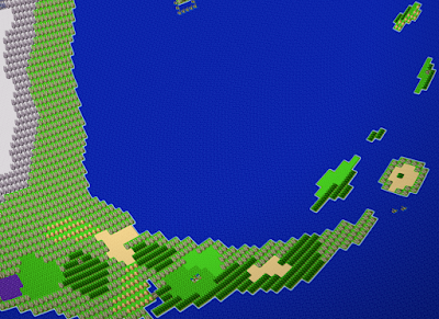
This shot of Aliahan is probably one of the most interesting. On a globe it's much closer to Lancel and Leiamland than it seems in the game, and is fairly out of the way compared to most other land masses. Journeys across the sea to Aliahan might be arduous ones. It puts perspective into why Aliahanian Empire must have collapsed without access to their portals.
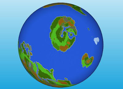
For Torland, I made another sphere inside of the globe and textured it with the DQ2 map, making sure to line up the Pit of Giaga with the spot you drop into Torland in 3. Here's Alefgard; note Lianport to the west.
- The Worldforest matches up with a spot in the middle of Torland's ocean, north of the Northern Continent and south of the Southern Continent. This would mean that the roots of the Worldtree would be jutting out of the water, potentially creating islands. This might limit trade between Erdland and Torland, but perhaps there are vast floating cities established there, built on top of rafts and ships or carved into the wood of the tree itself, to support the exchange.
- Aliahan is on the other side of Moonbrooke. The mountainous regions of both roughly line up, so one could easily include dwarven settlements connecting the two surfaces in those regions. A settlement like this that has since been abandoned would make a great megadungeon.
- Similarly corresponding mountain ranges include the one east of Baharata and the one west of the Spring of Courage in Samartoria, the mountains in the south of Suland and the mountains around Dirkandor, and the mountains in the east of Manoza and the mountains east of the Plateau of Rendarak.
- On the other side of Leiamland is a spot in the ocean just off the southwest coast of the island directly south of Alefgard. Notably, Leiamland is the equivalent of Antarctica, but its counterpart in Torland is right in the middle of the map. This would mean that Torland, as a concave surface around a central sun, doesn't really have poles the way we're used to - which explains why the snowiest area is Rhone, which is noted to be a high plateau, not anything to the extreme north or south. In keeping with the Nordic themes, it's possible that all of Torland has a climate similar to that of northern Europe.
- I was wrong about the placement of DQ2's Worldtree leaf in my last post. When the maps are visualized on a globe, that spot would correspond to one just off the coast of Greenlad. That is quite a bit away from the Worldforest. Perhaps this isn't a part of the same tree, but a separate tree from one of its seeds. Which raises the question of what happens if there are two Worldtrees competing for space...


No comments:
Post a Comment